Census illegibility

Greetings
Im trying to find the residence of my GGF who died in 1960. He lived in Merkel, TX and the 1950 Census Street name is illegible and I can't find any streets in the current map that look close. I don't think there is a city directory online or anywhere so I'm not sure how I can find out this information or tips to find out census illegible print issues
Answers
-
Good afternoon, @rwren1966
Could you share your GGF's name or PID (profile identifying code) from the FamilySearch Tree? With those details, we may be of more help.
Thanks.
1 -
KCJZ-495
0 -
@rwren1966 You might try Taylor County Auditors office for details since his occupation indicates he was a landlord or you could try the telephone company for old phone book records and possibly the local newspaper for the 1960's for want ads
1 -
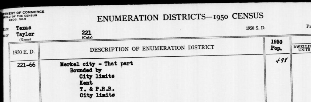
You can see the ED map and description on the NARA census website: https://1950census.archives.gov/search/?ed=221-66&page=1&state=TX#
It was a rural area. There may not be an actual street name.
 0
0 -
Hi @rwren1966.
On the previous page of the census, there's another family living at "511 El Paso". On your great-grandfather's page, the neighboring house number looks like 1428, but no street was included.
There's some surviving houses with the 1400 numbers in the surrounding blocks to El Paso Street. So, best guess is that the house was somewhere near there, in the northern part of the city.
0 -
@rwren1966 The census record attached to his profile is a '70-series' which was used on a subsequent visit to the residence because no one was at home on the enumerators first time thru the area. This is the sheet used on that first attempt and they are shown on line 7 '601 Marion'. Just a stone's throw from the previous Google Map provided by @GFre
Here's the Google map2 -
So at the top notes it reads 3< behind Gulf Station on "Front Street". Does it sound feasible that "Front" today is the current frontage road? There is actually a gas station now on the corner of Frontage and Marion. There is currently no 601 Marion St which is consistent with my dad telling me he remembered the house not being there anymore.
0 -
Being an 'odd' number it probably would have been on the west side of Marion. Probably at the location where 1406 N 6th as shown on the Google Image. The various notes at top and bottom of Census Sheet refer to line numbers such as Note 1 goes to Line 8, 2 goes to line 11, 3 to line 15 etc. Frontage street appears to be a product of when Interstate 20 was built. Front St I believe refers to what is now N 1st St aka Business 20
0 -
Makes sense
0

